PREVIOUS
✖
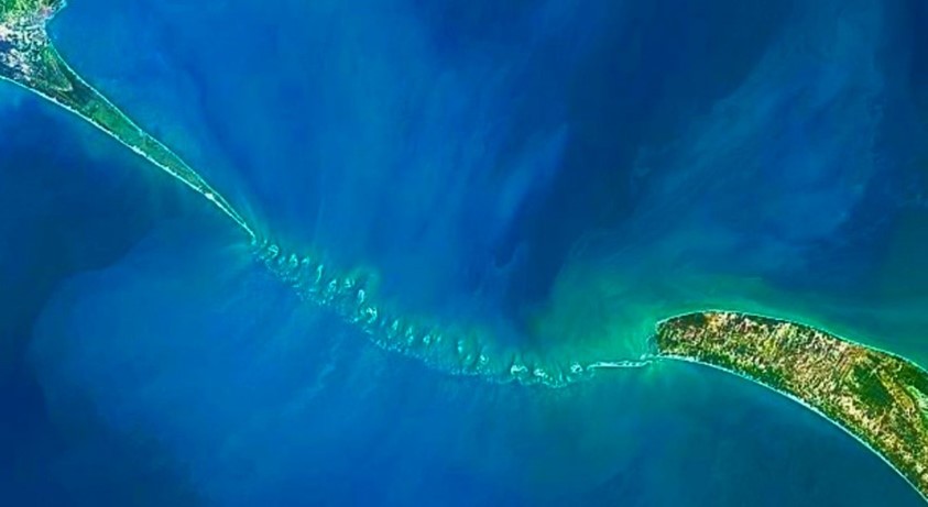
First complete Ram Setu Map
July 24 , 2024
12 hrs 0 min
26
0
- ISRO scientists have collaborated with NASA’s ICESat-2 satellite to successfully map out a comprehensive map of submerged Ram Setu also called Adam’s Bridge.
- The entire bridge can be seen through a 10-meter resolution map.
- The data has been collected over the due course of 6 years between October 2018 to October 2023.
- This is a first of its kind undersea map, which is 29 meters long and is 8 meters above the seabed.
- This ancient bridge connects Dhanushkodi in India to Talaimannar Island in Sri Lanka.
- According to the temple records in Rameswaram, the bridge was above sea level until 1480 when it was destroyed by a storm.

Leave a Reply
Your Comment is awaiting moderation.