PREVIOUS
✖
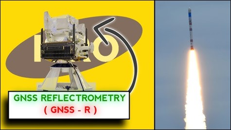
GNSS-Reflectometry (GNSS-R)
September 8 , 2024
18 hrs 0 min
11
0
- ISRO, has successfully demonstrated a satellite technique to capture data on soil moisture, surface inundation, and ocean surface wind and wave measurements.
- It used a satellite-based sensor that is 475 km above the earth.
- This novel method is known as GNSS-Reflectometry (GNSS-R).
- An instrument capable of performing this role was mounted on ISRO's EOS-08 satellite that was launched recently.

Leave a Reply
Your Comment is awaiting moderation.