PREVIOUS
Ancient Branch of Nile River
May 21 , 2024
338 days
580
0
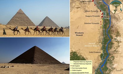
- Using satellite imagery, experts identified potential locations of an ancient river branch near the pyramid fields.
- Satellite images are indicating the presence of a 64-km-long former river branch that once flowed near the pyramid fields.
- They have proposed that the river branch be named “Ahramat” which means pyramids in Arabic.
- The researchers believe that the increased windblown sand, linked to a major drought that began approximately 4,200 years ago, likely caused the branch to migrate eastward.
- This migration, combined with the accumulation of sand, eventually led to the river silting up and disappearing.

Leave a Reply
Your Comment is awaiting moderation.


