PREVIOUS
Bhuvan Panchayat Geoportal 4.0
July 3 , 2024
301 days
714
0
- Centre has launched following two Geoportals developed by the Indian Space research Organization (ISRO).
- ‘Bhuvan Panchayat (Ver. 4.0)” portal for rural land record and
- “National Database for Emergency Management (NDEM Ver. 5.0)”
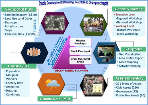
- These latest geospatial tools are meant for visualisation and planning to provide high resolution satellite imagery of 1:10K scale for different locations across the entire country.
- The ‘Bhuvan Panchayat Portal’ provides “Space based Information Support for Decentralized Planning (SISDP)” and empower the citizens at the grass root level in Panchayats’.

Leave a Reply
Your Comment is awaiting moderation.


