PREVIOUS
✖
Copernicus EMS Rapid Response Service
May 28 , 2024
336 days
479
0
- The European Union activated its emergency satellite mapping service at Iran’s request as adverse weather and darkness hampered search and rescue operations.
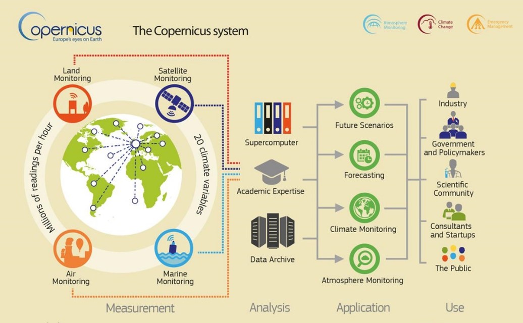
- The rapid response mapping technology is a critical component of the Emergency Management Service (EMS) within the Copernicus programme.
- It is named after the renowned 15th-century scientist Nicolaus Copernicus.
- The programme is the earth observation component of the European Union’s space initiative.
- Copernicus was launched in 1998, and was earlier known as the Global Monitoring for Environment and Security Programme (GMES).
- The programme uses global data from satellites, and ground-based, airborne, and sea-borne measurement systems to address issues related to climate change, disaster management, and agriculture, among other uses.
- Notably, data from the Copernicus programme is freely available and accessible to all.

Leave a Reply
Your Comment is awaiting moderation.