PREVIOUS
✖
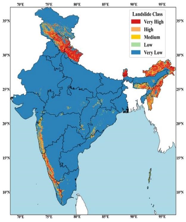
Indian Landslide Susceptibility Map
January 8 , 2024
326 days
719
0
- IIT Delhi team makes first hi-resolution landslide risk map for India.
- This map is the first of its kind by virtue of being on a national scale, leaving out no locations in the country.
- It also revealed some previously unknown places with high risk, such as some areas of the Eastern Ghats, just north of Andhra Pradesh and Odisha.
- It can help identify the most dangerous areas and help allocate resources for mitigation strategies better.
- Landslides are a unique and deadly problem in India.
- Unlike floods, they are less widespread and harder to track and study with the satellites.
- Landslides happen in very localised areas and affect only about 1-2% of the country.

Leave a Reply
Your Comment is awaiting moderation.