PREVIOUS
✖
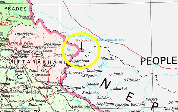
Kalapani territory
November 17 , 2019
1713 days
837
0
- In the recently released political map of India, after the bifurcation of the state of Jammu and Kashmir (J&K), the Kalapani territory became the bone of contention between India and Nepal.
- In the latest political map of India, India reiterated its claims on the region that Nepal considers its own territory in Darchula district.
- According to India, the historic Kalapani region forms part of the state of Uttarakhand.
About Kalapani
- Kalapani is a valley that is administered by India as a part of the Pithoragarh district of Uttarakhand.
- It is situated on the Kailash Mansarovar route.
- The Kali River in the Kalapani region demarcates the border between India and Nepal.
- The Treaty of Sugauli signed by the Kingdom of Nepal and British India (after Anglo-Nepalese War) in 1816 located the Kali River as Nepal's western boundary with India.

Leave a Reply
Your Comment is awaiting moderation.