PREVIOUS
✖
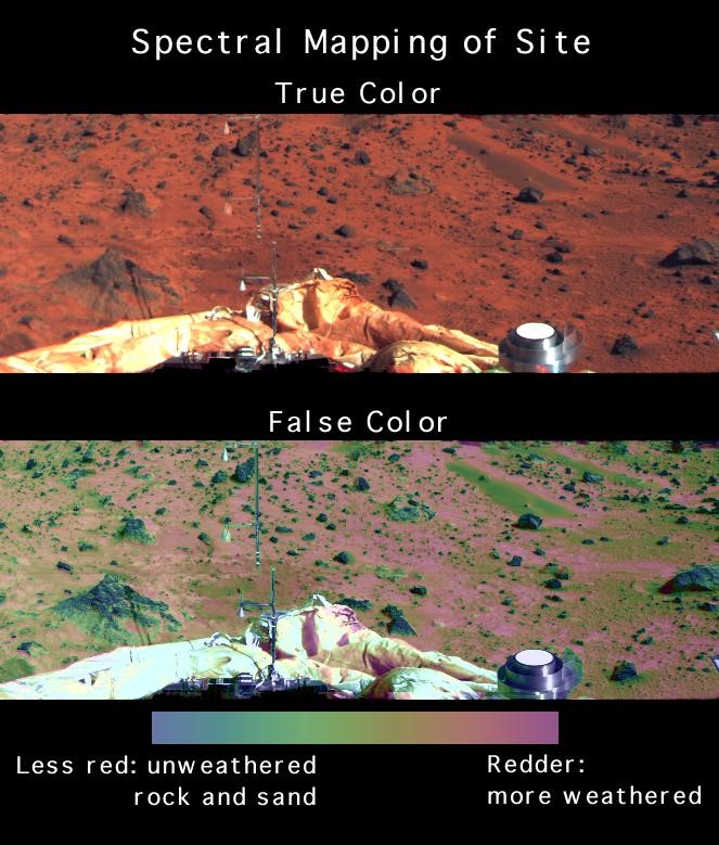
Multispectral maps of Mars
August 8 , 2022
841 days
773
0
- NASA made the first multispectral maps of Mars’ surface public.
- The 5.6 GB multicoloured map covers 86% of the area of the Red Planet.
- It will gradually distribute the whole map over the next six months.
- The data for the maps was captured by NASA’s Mars Reconnaissance Orbiter.
- It is the longest orbiting satellite around the planet.

Leave a Reply
Your Comment is awaiting moderation.