PREVIOUS
✖
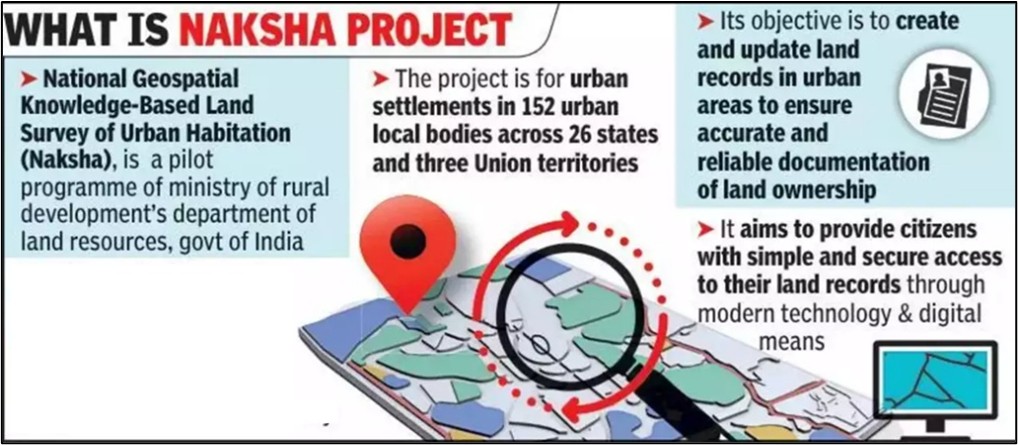
NAKSHA Pilot Project
February 20 , 2025
429 days
1946
0
- A national geospatial knowledge-based land survey of the urban habitations (NAKSHA), a pilot programme to modernise urban land records, was launched in Thanjavur.
- The programme is taken up under the Digital India Land Records Modernisation Programme of the Department of Land Resources of the Union Ministry of Rural Development.
- It aims at ensuring that the urban land records were accurate and up-to-date, empowering urban citizens and enabling better urban planning.
- The one-year pilot programme will be implemented in more than 150 cities across the country.
- Under the programme, drones would be deployed to carry out geospatial mapping and create accurate property records.
- The data would be integrated with the property tax records of the urban local bodies.
- Advanced land survey devices would be used to create the maps.

Leave a Reply
Your Comment is awaiting moderation.