PREVIOUS
✖
Subsurface Water Ice Mapping project
November 6 , 2023
386 days
381
0
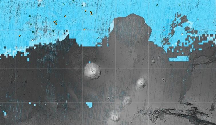
- The NASA-funded Subsurface Water Ice Mapping (SWIM) project released its fourth and most recent map of where on Mars.
- This map will help mission planners decide where on Mars to actually send the first humans to traverse the planet.
- The recently released fourth set of maps is the most detailed and accurate since the project started in 2017.
- The new map includes sightings of so-called “polygon terrain.”
- There are the seasonal expansion and contraction of subsurface ice causes the ground to form polygonal cracks, indicating more ice hidden beneath the surface.

Leave a Reply
Your Comment is awaiting moderation.